Showing posts with label tramping. Show all posts

16 July 2017

Tramping the Nina and Doubtful Rivers Lake Sumner Forest Park

I have just been tramping! The first time for a while and only the second time since a knee cartilage operation in 2016.

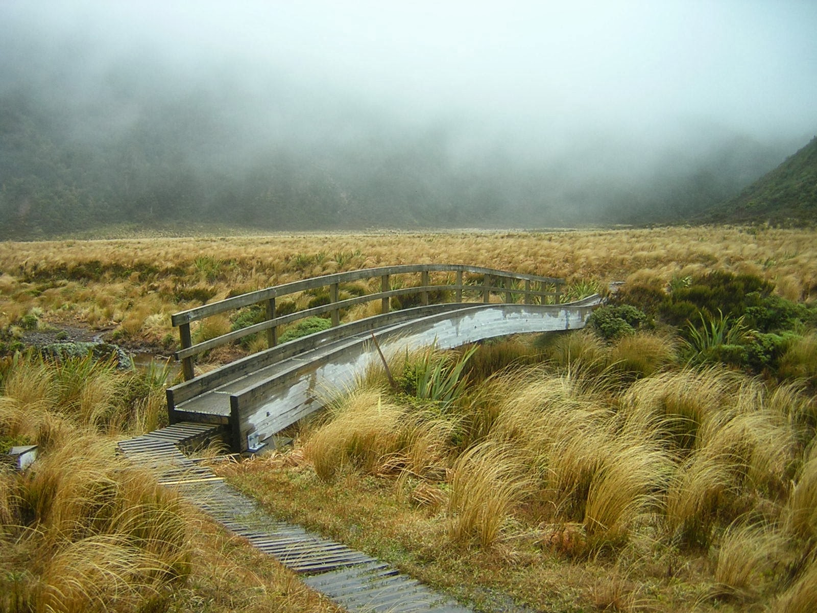
The photograph to the left is of Upper Nina Biv.

With three old friends I spent four nights and three days in the Lake Sumner Forest Park.

From 8 July to 11 July 2017 we tramped up the Nina River, to Nina Hut. We day-tripped to Upper Nina Bivvy and then crossed Devilskin Saddle (after visiting Devils Den Bivvy) to the Doubtful River and we stayed our last night at Doubtless Hut.

Finally we walked out to State Highway 7 and drove to my friends' relatively new 'bach' at St Arnaud just before snowfalls closed Lewis Pass.

I have popped my ten better photos to an album on Flickr. And the photo below is the result of some 'Flickr 'embed' script.

Nina and Doubtless Rivers July 2017

What did I learn and bring back from the tramp?

I could say that oh: I took too much food (I had some left at the end). I needn't have taken a pair of fleece pants (yes it was cold, we all tramped in 'polypro' tights but a spare dry pair of tights would have been lighter). And never omit your sleeping mat! (It should always be in your pack even on a 'huts' trip and even more so in winter!)

But that's just a checklist for next time.

When the trip was being planned I said I'd only tramped in the area once or twice. Actually I'd temporarily forgotten I had done a lot of tramps between Lake Sumner and Lewis Pass. The trip evoked a lot of memories and a lot of yarns ("There was another trip I may not have mentioned, where we bush-bashed up to Brass Monkey Biv..") which my long suffering tramp companions politely heard out.

Even little-suspecting fellow trampers we met heard a few yarns! We meet two wonderful women teachers from Christchurch who were outdoor instructors. It of course turned out we knew friends in common and that launched more tall tales from our respective archives.

The big wake-up for me was that although I do look like a bald and white-haired 55 year-old with a lined-face, I got that way by doing a lot of tramps and other adventurous things!

And also that my old tramping friends are still my bestest-ever friends.

17 May 2013

A Northern Crossing of the Tararua Range with Robin in 1987

Last night I was sorting through some of Robin's many photographs.

I found some great photos of us tramping in the Tararua Range in 1987, 25 years ago.

It was more or less on Robin's 60th birthday, which was 19 December 1987. We did a Northern Crossing, from the west or Otaki/Levin side out to the east or Masterton side of the range.

That is me and Robin outside Arete Hut No. 2. I guess we met some one who took this photo. I still have that fairydown jacket.

This is just me outside Arete Hut No. 2 on 20 December 1987. I have changed jacket. Did Robin take that photo? 

This is me approaching the old Tarn Ridge Hut (old) (aka Blatchford Memorial Hut) on 20 December 1987.  
This is me outside the old Tarn Ridge Hut on 21 December 1987.  

This is a sequence of three photos that I took from Girdlestone Trig. They show Robin walking down the ridge towards Mitre Peak, with bright light shining off the wind-swept tussock grass, with Table Ridge in the mid background and the Bannister Waingawa ridge in the far background.
 

This is me at the old Mitre Flats Hut on 21 December 1987.

31 December 2012

Christmas in the Ruahine Range

I went tramping from Christmas Day until yesterday the 30th December, in the Ruahine Range.

I started at the North Block road-end, about 35 km inland from Waipukarau in the Hawkes Bay region. Right at the North Block road-end is Triple X Hut.

On the 25th, I left the car at about 12:40 and walked up the well-maintained Sunrise Track. This track zig-zags up a spur through luxuriant red beech forest interspersed with rimu, miro and mistletoe. I got to Sunrise Hut at 3:00pm.

In spite of the misty but warm and humid conditions, I continued up to Armstrong Saddle and headed northwards on the main divide of the Ruahines towards Sparrowhawk Bivvy. Within 30 minutes, the mist had cleared, and I had several fine hours of good visibility to traverse the largely untracked tops to the biv, before arriving at 8:15pm.

Note that the bivvy is nestled just off the tops amongst leatherwood shrubs and stunted Mountain beech trees. The bivvy has two distinct parts; the lower original NZ Forest Service 'dogbox' biv structure and the larger attached vestibule added by DOC. It provides a lot of utility as it has a bench seat and a cooking bench. ANd you can stand up in it.

I am afraid that's it for photos. I took the Sparrowhawk Biv photos on my cell phone. I had no spare batteries for my digital camera.

After waiting out a migraine, and a day's rain, I tramped further along the tops in mist again, before dropping down to Maropea Forks Hut. Of biodiversity interest, was seeing a couple of Powelliphanta snails and shells in the tussock herb-fields above Sparrowhawk Biv.

That night at Maropea Forks Hut I met a lovely couple from Auckland, Brinley and Connie. Later that evening, near the hut, I saw a rifleman.

The next day I tramped up the Maropea River (where I saw one blue duck) to Top Maropea Hut, an excellent-condition NZ Forest Service design 4-bunk hut with a great outlook. The outlook back over the Ruahines was so nice in the afternoon sun, that I sat for too long with no shirt on, drinking a cuppa, and reading a 'New Scientist' magasine, that I got sunburnt shoulders.

Finally, yesterday, I tramped out to Triple XXX carpark via Amstrong Saddle, Sunrise Hut and the Sunrise Track again before driving home.

25 July 2011

Ruahine Range 23 to 24 July

I went tramping to the Ruahine Range in the weekend. Here are some pictures.

This is entering the Ruahine Forest Park from the farmland at the end of Mangakukeke Road, about 30 km from Mangaweka.


Pahautea Libocedrus bidwillii on the bushline at the old hut site.


Purity Hut, a new (2006) DOC 6-bunk hut.


Hut inhabitant. Do not feed.

23 February 2011

Robins primus 71 part 2

Here is Robin's Robins Primus 71 stove, with the stand and the billy/container.

Here is a photo of just the stove.

Here is the Primus stamp on the base of the stove.

The stove in the billy (pot) stand.

Here is the underside of the base of the stove with the 'AU' date stamp clearly visible. As we know, according to the Primus Date Chart, 'AU' means Robin's stove is the 1955 model.

Today I lit it, boiled some water and made a small plunger of coffee. As I sipped I raised my mug in salute to Robin.

22 February 2011

Robins Primus 71 stove

Robin's tramping and climbing stove is a 1955 Swedish Primus 71E.

The website "Classic Camp Stoves" has a gallery of Primus 71 stoves.

Robin's Primus 71E stove set includes a cylinder-shaped stand and a pot that doubles as a container for the stove. That is in distinction to the Primus 71 or 71L stoves that have a square 'tea caddy' shaped stand and container but without a pot.

It still works. I started it yesterday. Robin bought it new in the 1950s in Christchurch when he was very actively mountaineering with the Canterbury Mountaineering Club (CMC).

I have fond memories of the stove's roaring sound as it cooked our "de-hi" curry on many a tramp with Robin in the 1970s and 1980s.

Here is a video of lighting a Primus 71.

Here is a You Tube instructional video, helpfully in Swedish, on how to light a Primus 71.

This is a gallery about Primus 71 stoves.

Primus stoves can be dated via a stamp on the base. Robin's stove is stamped 'AU' on the bottom, which confirms 1955.

There are more shiny primus photos at Google. Are they not beautiful?

15 February 2011

Summertime

Yes it is. Its also February. That's my month.

This video of 'Summertime' by Janis Joplin really seems to jump out of the speakers.

Joplin's music always reminds me of driving out across Porters Pass, the Torlesse range and the Craigieburn range on the way to the upper Waimakariri River and Arthurs Pass to go tramping.

I used to have a couple of well-used Janis Joplin tapes in my Nissan Bluebird station wagon.

Summertime!.

02 March 2010

Ruahine Corner and back

On Saturday, Sunday and Monday I went tramping in the Ruahine Ranges to Ruahine Corner Hut. I went with 'Dr Fi' and her running and multi-sport friend Pip. The trip was:
Friday afternoon. We drove over the Rimutakas and up the east coast via State Highway 50 until we were about 40-50 km from Hastings. Just after Tikokino we turned off SH50 onto Kereru Road, then Big Hill Road, then along Mangleton Road.
Saturday. Masters Shelter, Golden Crown ridge, Aranga Hut, Main Range, Piopio, spot height 1503, Potae, Ruahine Corner. A 12 hour day.
Sunday. Walk across Ruahine Corner airstrip, follow stoat trap line down a spur to Ikawatea Forks Hut, walk up the non-maintained track to Trig 1407m to 'No Mans'. An 11 hour day.
Monday. Walk south along the range to the junction with Golden Crown ridge, drop down to Masters Shelter and drive back to Wellington.

23 July 2009

Pictures of Robin

At Robin's funeral we had a 'memory board' - a display of photos of Robin.

Based largely on the same photos here is an image gallery.

18 July 2009

Its a year now

Today is the 18th of July 2009. It's the first anniversary of Robin's death. I marked the day by walking from Karori West via Makara Road and Johnston's Hill to Mt Kaukau, along the ridges just west of Karori, Wilton, Chartwell and Ngaio. Although I had not walked to Mt Kaukau for at least fifteen years, Robin and I had walked from Mt Kaukau many times.

The overcast weather cleared as I walked and the afternoon became fine and warm until the final gentle climb to Mt Kaukau when the sun was low over the Tasman Sea. There was no wind and no movement of the Makara 'West Wind' turbines. The Ohariu valley farmland was a gleaming shade of green in the low winter sun.

When Robin and I first walked from Mt Kaukau to Johnston's Hill, in the 1970s, the walk was an informal route mostly over private farmland. Now, Wellington City Council has negotiated formal access for both walkers and mountain bikes, the route is sign-posted as are the ways off the main route to the suburbs, and it has a name. "the Skyline". Robin just used to call the walk 'Mt Kaukau to Johnston's Hill'.

I left home in Allington Road at 11:30am, started 'the Skyline' route at 11:45am at Makara Road, and reached Mt Kaukau at 3:15pm. I walked down to Nairnville Park (Cockayne Road) and caught a No 44 bus to the Railway Station then a No 3 bus back to Karori.